Log in
All resources
Create a design
338 Free Artworks of 1800 Maps
bibliothèque nationale de france
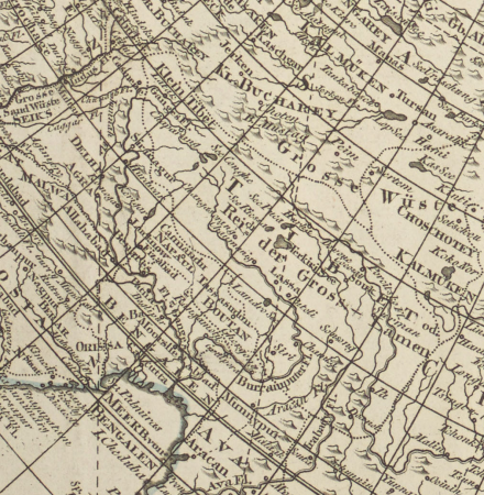
atlas of the russian empire (1800)
maps from the earth and its inhabitants, vol. xi
files from the bodleian libraries
algeria in the 1800s
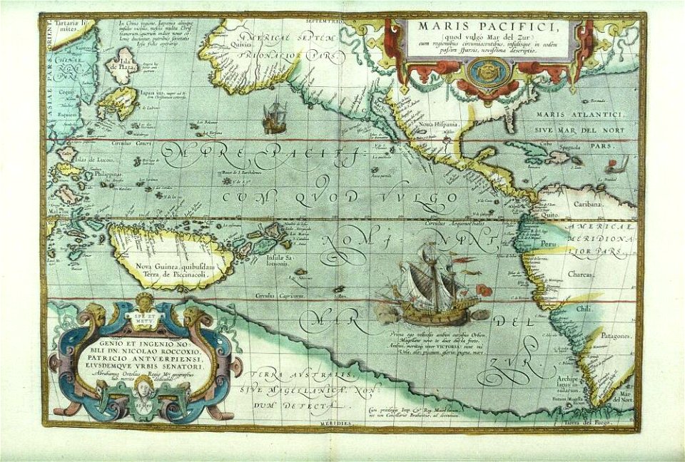
theatrum orbis terrarum (london 1606)
maps in portrait paintings
maps by john cary
john cary
1800s maps of the world
atlas of the russian empire (1800)
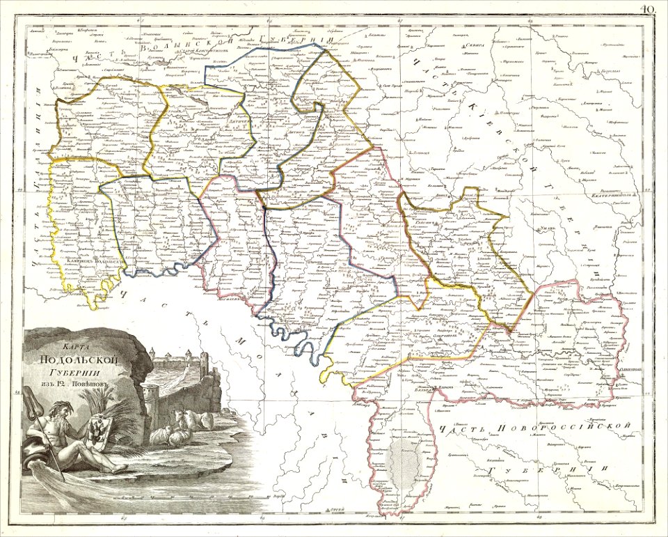
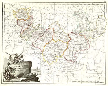
maps of podolia governorate
atlas of the russian empire (1800)
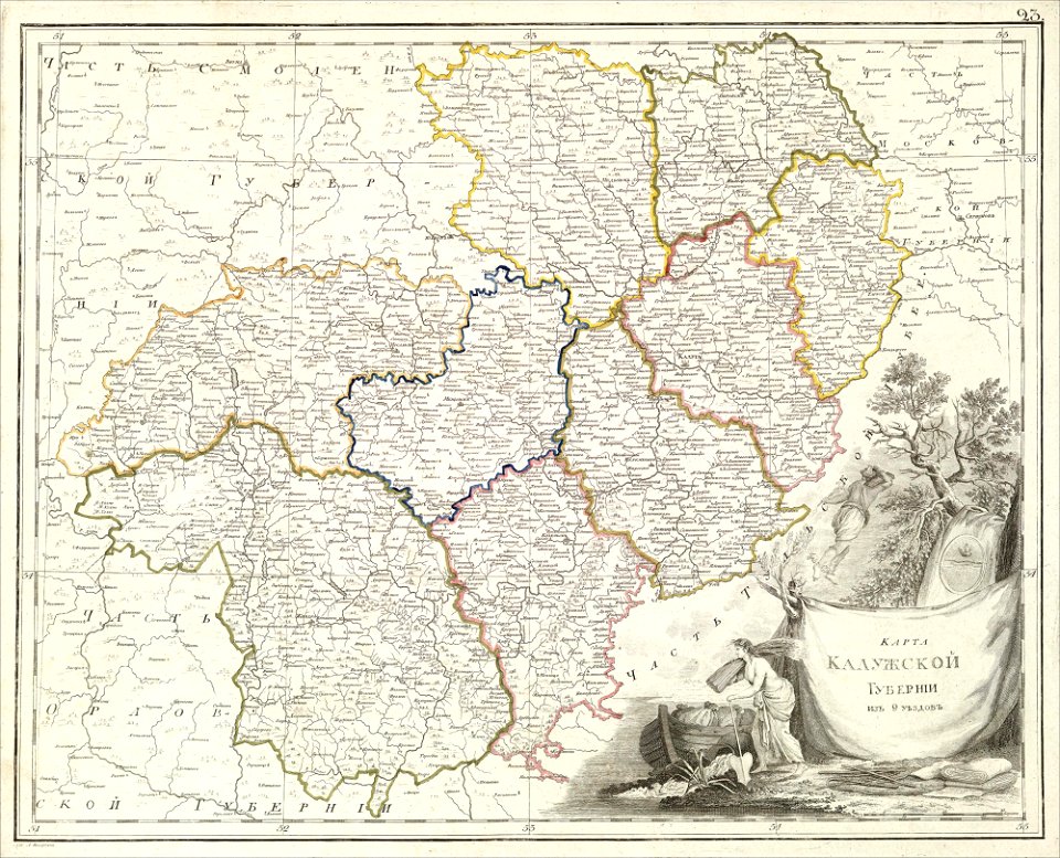
old maps of kaluga governorate
atlas of the russian empire (1800)
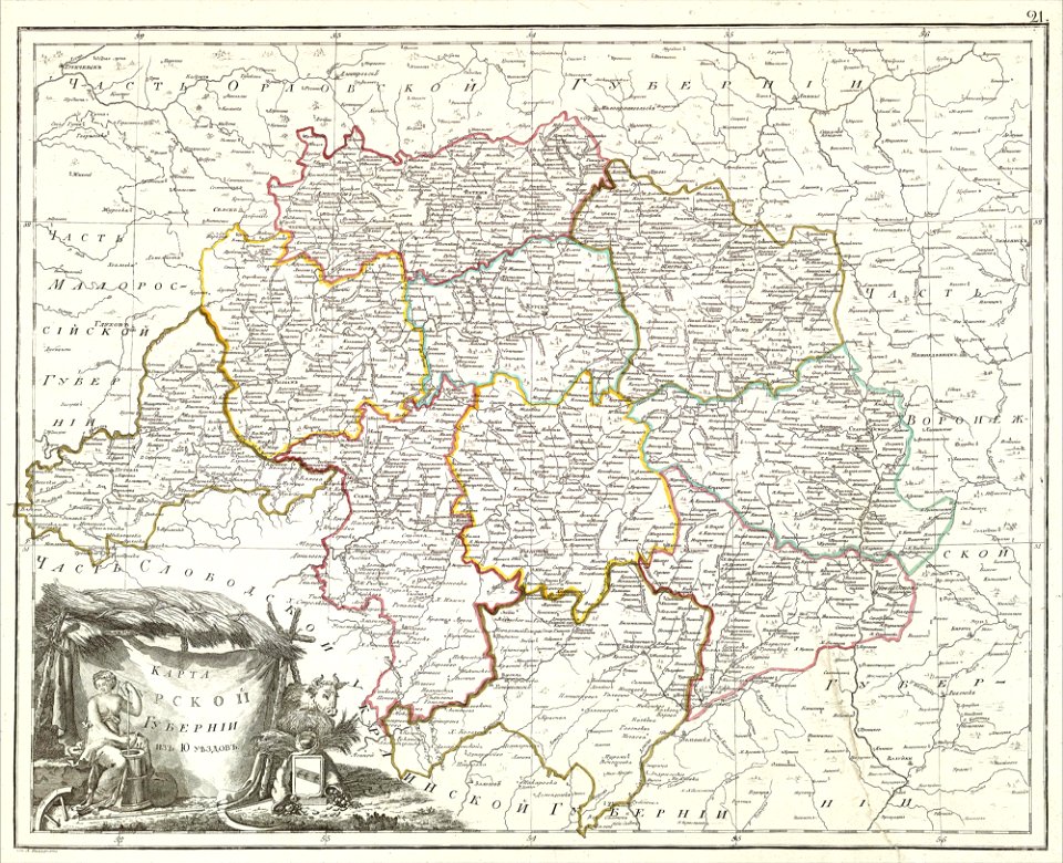
old maps of vyatka governorate
atlas of the russian empire (1800)
old maps of kursk governorate
atlas of the russian empire (1800)
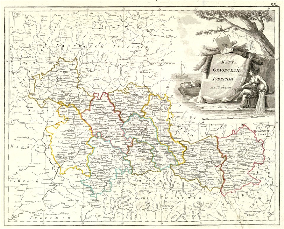
old maps of oryol governorate
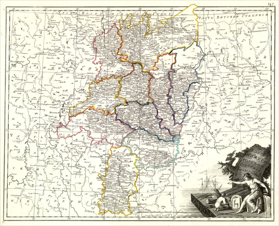
maps of nizhny novgorod governorate
atlas of the russian empire (1800)
atlas of the russian empire (1800)
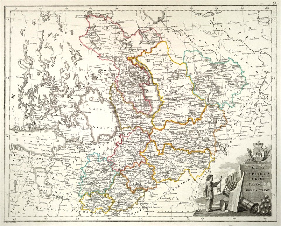
old maps of novgorod governorate
atlas of the russian empire (1800)
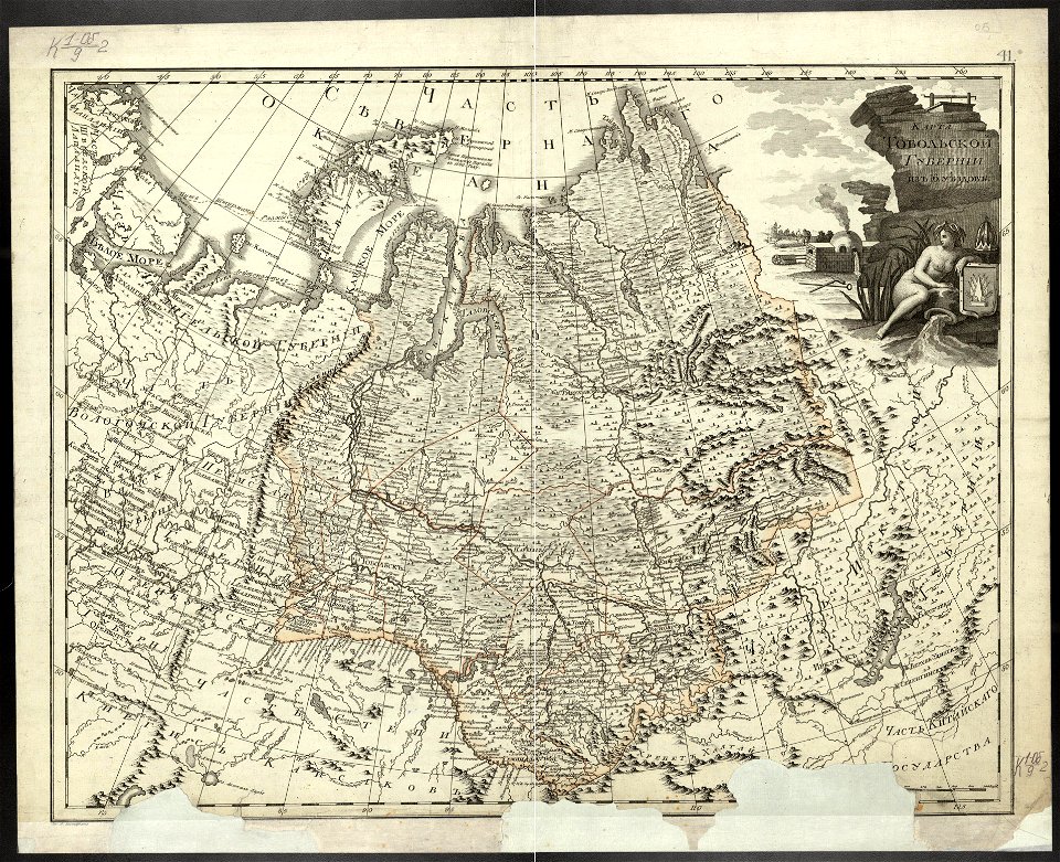
old maps of tobolsk governorate
africa
maps
old maps of saint petersburg governorate
atlas of the russian empire (1800)
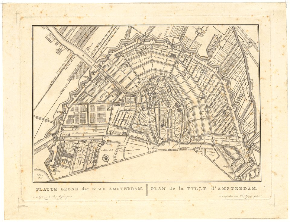
old maps of amsterdam
pierre fouquet junior
maps in russian state archives of ancient documents
historical images of haradok
old maps of amsterdam
pierre fouquet junior
old maps of amsterdam
pierre fouquet junior
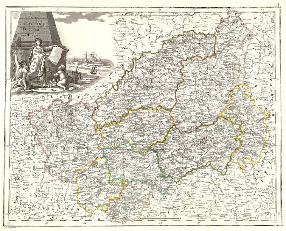
atlas of the russian empire (1800)
tver governorate
ocean
maps
sketch
maps
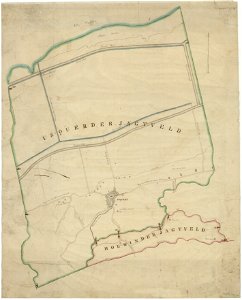
holwinde
usquert
atlas of the russian empire (1800)
old maps of kharkov governorate
maps from the mechanical curator collection
old maps of prussia
collections de la bibliothèque nationale et universitaire de strasbourg
maps of strasbourg in the 18th century
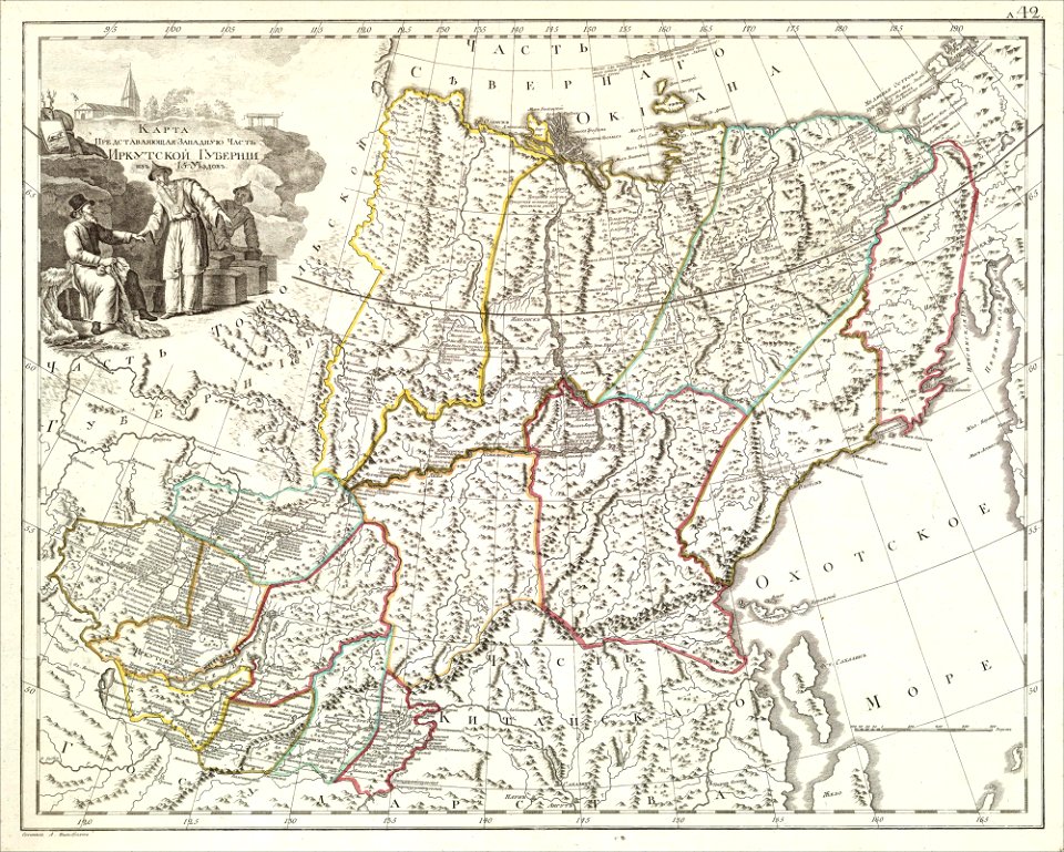
atlas of the russian empire (1800)
old maps of irkutsk governorate
globe
maps
mdcclxxvi (numeral)
1776 maps
cornell: persuasive cartography: the pj mode collection
cornell university library
theatrum orbis terrarum (london 1606)
files from the bodleian libraries
theatrum orbis terrarum (london 1606)
files from the bodleian libraries
theatrum orbis terrarum (london 1606)
files from the bodleian libraries
theatrum orbis terrarum (london 1606)
files from the bodleian libraries
theatrum orbis terrarum (london 1606)
files from the bodleian libraries
files from the bodleian libraries
napoleonic wars
theatrum orbis terrarum (london 1606)
files from the bodleian libraries
theatrum orbis terrarum (london 1606)
files from the bodleian libraries
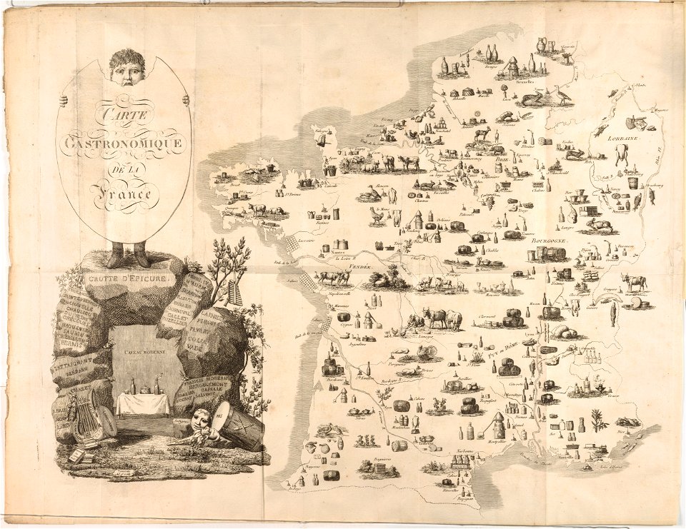
french cuisine
gastronomy
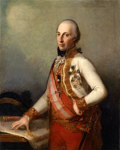
archduke charles
duke of teschen
portrait paintings with natural background
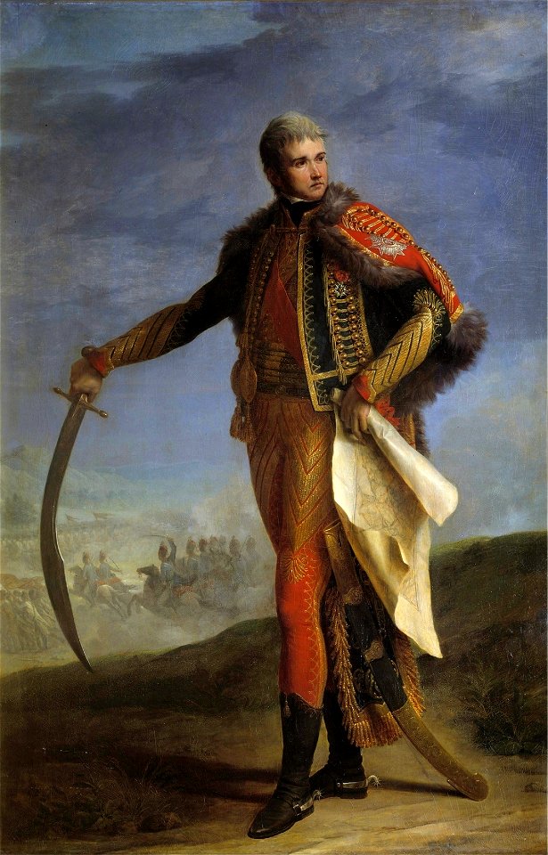
jean lannes
domenico pellegrini
london
old maps of ireland
ireland
maps of the west-indische compagnie
1800 maps of the united states
archduke charles
duke of teschen
19th-century portrait paintings in the musée national du château de versailles
jean charles nicaise perrin
maps by john cary
1806 maps of asia
19th-century maps of southeast asia
aristide-michel perrot
1800s maps of the world
old maps of the world
athens in the ottoman era
old maps of athens
cornelis huyberts
guillaume sanson
alexis-hubert jaillot
henri sengre
maps of alsace by guillaume sanson
1700s maps of alsace
voyages and travels to india, ceylon, the red sea, abyssinia, and egypt, vol. 3
henry cooper (engraver)
maps of the course of the rhine by guillaume sanson
bibliothèque nationale de france
a voyage to abyssinia, and travels into the interior of that country, executed under the orders of the british government in the years 1809 & 1810
john outhett
paintings by wybrand hendriks
proveniershof, haarlem
maps of the history of düsseldorf
düsseldorf-altstadt
maps of the course of the rhine by guillaume sanson
guillaume sanson
maps of wissembourg by braun & hogenberg
maps of rouffach by braun & hogenberg
1800 maps of the atlantic ocean
1800s maps of the americas
1800s maps of london
1801 in london
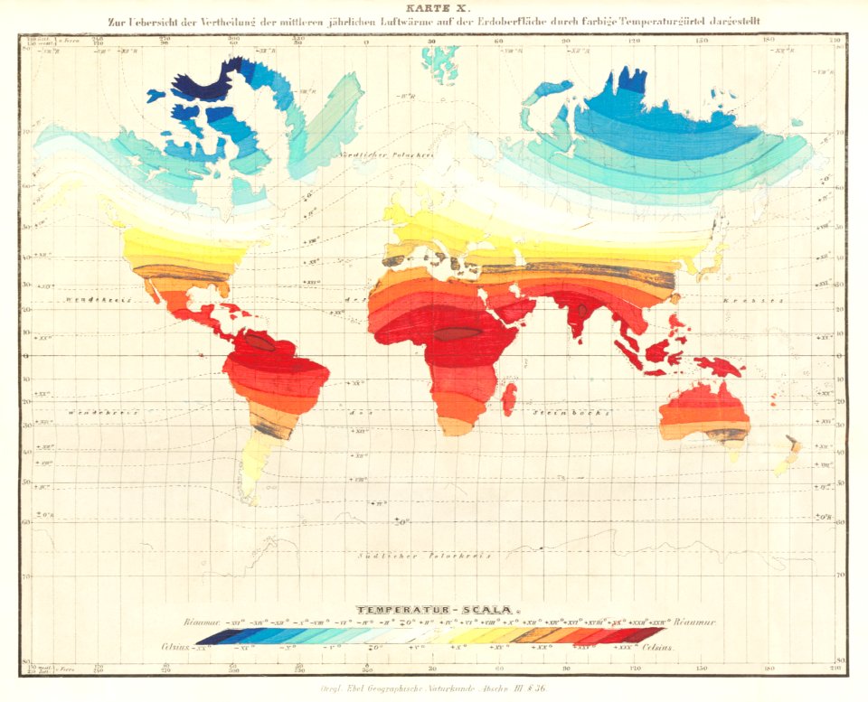
maps from the earth and its inhabitants, vol. x
1890 maps of africa
bibliothèque nationale de france
guillaume sanson
maps by john cary
1801 maps
birch's views of philadelphia
maps of philadelphia
maps, prints and photographs in royal danish library
old maps of kiel
maps from the earth and its inhabitants, vol. xi
algeria in the 1800s
19th-century maps of greece
pierre françois tardieu
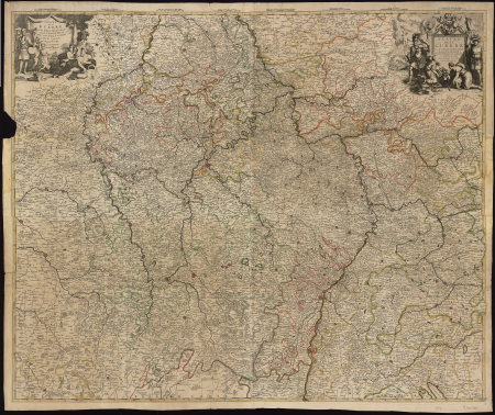
maps of alsace by guillaume sanson
1660s maps of alsace
maps of territories in the lower saxony circle
maps by john cary
the loyal west in the times of the rebellion
1803 maps of the united states
maps from the earth and its inhabitants, vol. xi
algeria in the 1800s
19th-century maps of bohemia
19th-century maps of silesia
old maps of the northern hemisphere
1800s maps of the world
maps from the earth and its inhabitants, vol. xi
1800s maps of algeria
1800s maps of the netherlands
evert maaskamp
carte de moscovie by guillaume de l'isle (1706)
1700s maps of russia
19th-century portrait paintings in the musée de l'armée
nicolas gosse
1800s maps of the iberian peninsula
maps of spain by tomas lopez
johann heinrich schmidt (fornaro)
baroque
map collection of leibniz-institut für länderkunde
1800s maps of the world
old hemisphere world maps (partner files)
1800s maps of the world
bibliothèque nationale de france
guillaume sanson
maps from the earth and its inhabitants, vol. xi
algeria in the 1800s
düsseldorf in the 1800s
old maps of düsseldorf
eran laor cartographic collection
pierre françois tardieu
maps from the earth and its inhabitants, vol. xi
algeria in the 1800s
maps from the earth and its inhabitants, vol. xi
algeria in the 1800s
maps from the earth and its inhabitants, vol. xi
algeria in the 1800s
a voyage to abyssinia, and travels into the interior of that country, executed under the orders of the british government in the years 1809 & 1810
john outhett
antoine-françois tardieu
jean-baptiste poirson
maps from the earth and its inhabitants, vol. xi
algeria in the 1800s
situs terrae promissionis by christian van adrichom
old maps of the stations of the exodus
antoine-françois tardieu
maps from gallica
1803 in berlin
1803 maps
1800s maps of the iberian peninsula
maps by john cary
maps from the earth and its inhabitants, vol. xi
algeria in the 1800s
map collection of leibniz-institut für länderkunde
maps of spain by tomas lopez
maps of the divisions of the polish-lithuanian commonwealth
karol de perthées
maps of the divisions of the polish-lithuanian commonwealth
karol de perthées
maps from university of amsterdam special collections
atlas der neederlanden
maps of paris from bibliothèque nationale de france
ludovic baschet
maps of the course of the rhine by guillaume sanson
bibliothèque nationale de france
old maps of former departments of france
maps from gallica
101 - 200 of 338
Next page
/ 4


![Alsace divided into its main parts: namely the landgraviates of Upper and Lower Alsace and the Suntgaw / by Mr. Sanson, ...; Cordier sculpted; [cartouche] S[imonneau] f., 1700](https://cdn.creazilla.com/illustrations/10000469742/alsace-divided-into-its-main-parts-namely-the-landgraviates-of-upper-and-lower-alsace-and-the-suntgaw-by-mr-sanson-cordier-sculpted-cartouche-simonneau-f-1700-md.jpg)


![Topographical Map of the Department of Montenotte / Written by the care of Mr. Count de Chabrol Prefect. Scale of 10,000 Meters [=Om. 050; 1: 200,000]; Drawn by Cecchi, geographer, between 1806 and 1812](https://cdn.creazilla.com/illustrations/10000886036/topographical-map-of-the-department-of-montenotte-written-by-the-care-of-mr-count-de-chabrol-prefect-scale-of-10-000-meters-om-050-1-200-000-drawn-by-cecchi-geographer-between-1806-and-1812-sm.jpg)